The Okavango Delta in northern Botswana is a mosaic of water paths, floodplains and arid islands. The delta sits in the Okavango river basin, which spans three African countries: Angola, Namibia and Botswana.
Because it’s an oasis, in a semi-arid area, it hosts a rich array of plants and attracts a huge variety of wildlife.
As a unique ecosystem, in 2014 it was placed on UNESCO’s World Heritage list and it is an iconic tourist destination, which generates 13% of Botswana’s GDP.
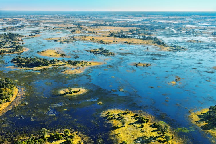
But it’s a fragile natural area. It’s controlled by deformations of the Earth’s crust over a long time (thousands to millions of years) and by annual water flows and evaporation. The size of the flooded delta from year to year varies between 3,500km² and 9,000km² because of weather fluctuations which control its water supply.
Any change to the processes that form the delta will have an impact on the wildlife and local economic activities. Its grassy floodplains are food for grazing animals in the dry period. Losses of this habitat will cause declines in wildlife and livestock. It’s therefore imperative to understand what creates and sustains the delta for the future management of the system.
We have conducted several studies that cover how the Okavango basin was formed and the way dissolved chemicals are withdrawn from the delta’s surface.
The dynamic history of the Okavango Delta’s waterways and floodplains tells us that the interplay between geology, water and plants makes the delta resilient, but vulnerable


No comments:
Post a Comment